

Guaymas · center
Templo de San Fernando
The parish church is an architectural focus of central Guaymas. Combine it with the civic square and a walk through the older streets near the port.
Photo: Gsoberon · CC BY-SA 3.0. Resized; card crop.

Sonora · City & town guide
A port city with historic squares and San Carlos on its doorstep
Guaymas brings a working-port perspective to Sonora’s coast. Start with San Fernando and Plaza de los Tres Presidentes, then move to San Carlos for beaches and bay scenery. A hotel in the port and a resort in San Carlos offer different experiences; check the actual address when choosing.
Enlarge photo ↗Photo: Gsoberon · CC BY-SA 3.0. Resized; card crop.
Nine ideas in Guaymas and the surrounding region. Each card names its location; combine nearby stops and allow a separate journey for outlying sights.
Guaymas · center
The parish church is an architectural focus of central Guaymas. Combine it with the civic square and a walk through the older streets near the port.
Photo: Gsoberon · CC BY-SA 3.0. Resized; card crop.

Guaymas · center
The civic square connects the city’s public history with its municipal architecture. It is a useful starting point for a short central Guaymas walk.
Photo: Toncec · CC BY-SA 3.0. Resized; card crop.

San Carlos
Boats, restaurants and views toward Tetakawi give the marina area an easygoing waterfront rhythm. It is also a practical place to clarify details for an organized sea outing.
Photo: eflon from Ithaca, NY · CC BY 2.0. Resized; card crop.
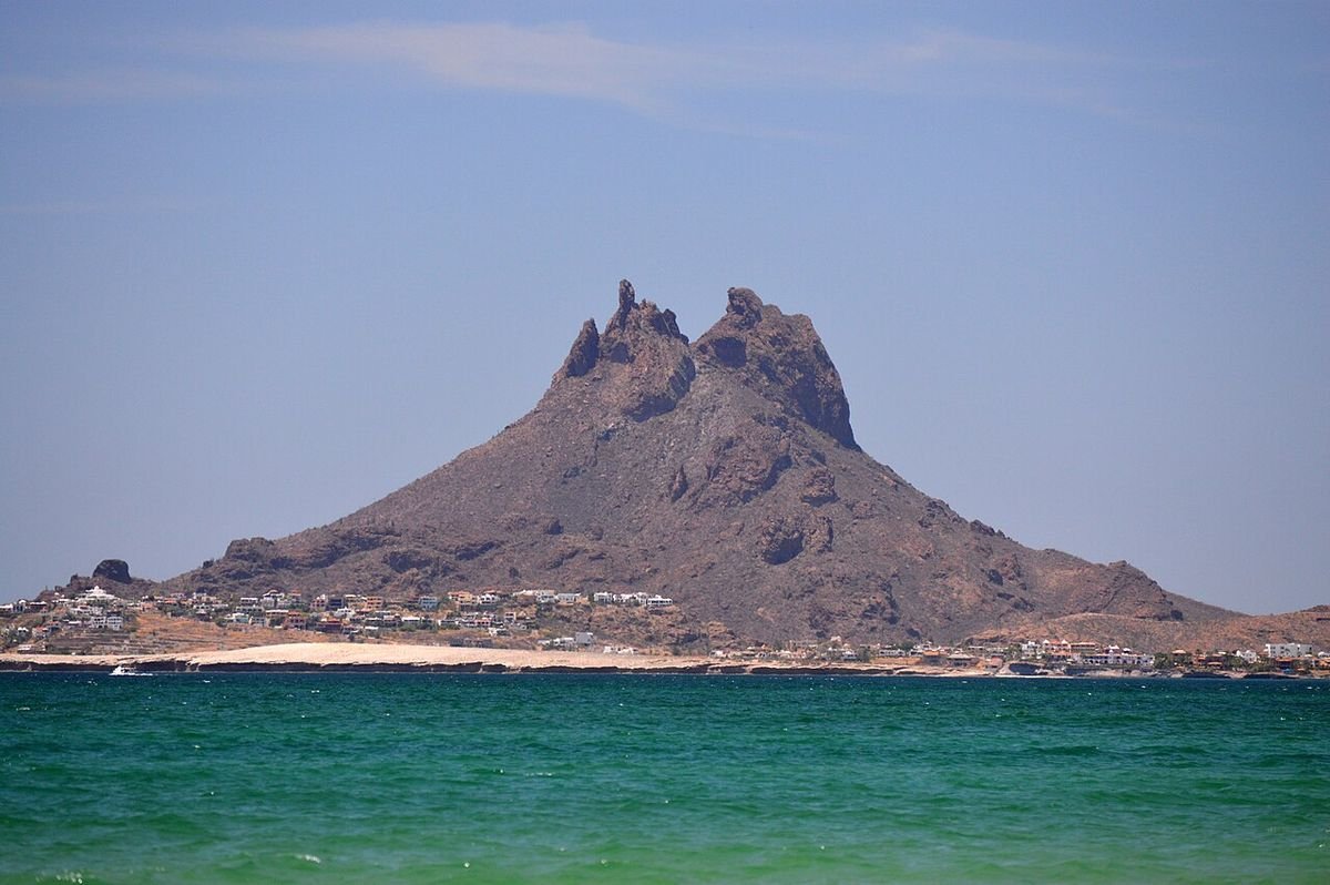
San Carlos
Tetakawi’s twin rock peaks give San Carlos its distinctive skyline. Coastal viewpoints allow visitors to enjoy the mountain and sea together without committing to a demanding climb.
Photo: Gabriel Perez Salazar · CC BY-SA 4.0. Resized; card crop.
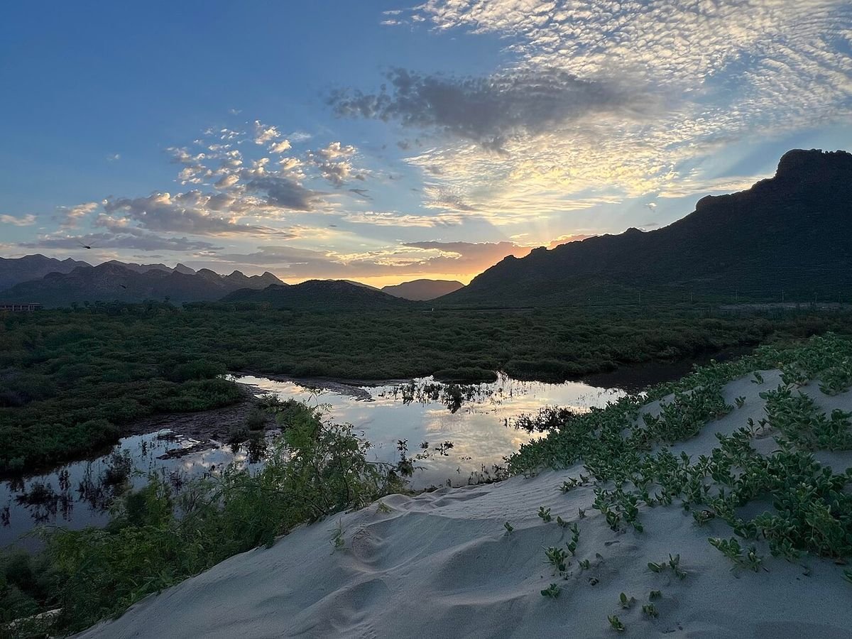
San Carlos · western coast
A long sandy shoreline and desert-backed scenery make Los Algodones a useful beach choice outside the central marina area. It works well as a separate half-day.
Photo: WendyAvilesR · CC BY 4.0. Resized; card crop.
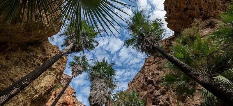
North of San Carlos
Rock walls and desert vegetation make this canyon a different outdoor experience from the waterfront. The walking terrain calls for suitable shoes and a realistic assessment of the heat.
Photo: OCV Guaymas–San Carlos. Resized; card crop.

Ciudad Obregón
The urban lagoon is a popular place for a leisurely walk and a break from city traffic. It offers a simple outdoor stop without committing to a rural drive.
Photo: Francisco Javier Espinoza Pérez · CC BY 2.0. Resized; card crop.

Cócorit · near Ciudad Obregón
The village combines a central square, traditional streets and colorful murals. It works well as a focused cultural outing from Ciudad Obregón.
Photo: WendyAvilesR · CC BY 4.0. Resized; card crop.

Cócorit
The museum introduces Yaqui history and cultural life through its collections and interpretation. It provides essential context beyond a quick photograph of the village.
Photo: WendyAvilesR · CC BY 4.0. Resized; card crop.
Allow two or three nights for a historic-center walk and a full coastal day. Group the church and civic square together. Choose either a beach-and-marina day in San Carlos or a canyon outing rather than rushing through every stop. Continue south toward Obregón and Cócorit with another overnight.
Make time for a straightforward seafood lunch and a town breakfast. A waterfront or resort meal in San Carlos is a different outing with transport attached. Ask what is available that day and check the final price for shared seafood platters.
The port, central squares and San Carlos are not one walkable district. Plan transfers between them and avoid entering working harbor areas without authorization. Confirm current passenger services directly if arriving by sea; do not assume a sailing from an old timetable.
Ask venues about steps, uneven surfaces and assistance if access matters for your party. See our Mexico travel-planning guide for the wider journey.
Compare nine hotels and regional bases on our separate lodging page, with photos, location notes and direct property links.
Hotels for Guaymas →Photo: Gabriel Perez Salazar · CC BY-SA 4.0. Resized; card crop.
Laguna del Náinari, Cócorit and a base for the southern valley
Photo: Francisco Javier Espinoza Pérez · CC BY 2.0. Resized; card crop.

Arcaded streets, a historic church and southern Sonora’s mountain setting
Photo: Hazlo · CC BY-SA 3.0. Resized; card crop.
Original ATA visitor notes and suggested itineraries, informed by Sonora tourism and the individual venues. Official references are provided for opening arrangements; photographs are credited alongside each image.


