
Big Bend National Park
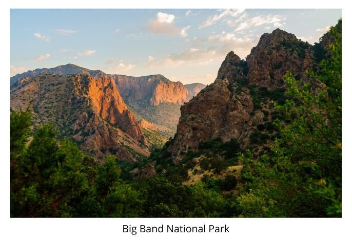
Leave Fort Davis on TX 118, and drive south to Alpine. Then turn east on US 90 to continue your scenic drive through the Del Norte Mountains to Marathon, where you drive south on TX 385 into Big Bend National Park. This last remnant of the border wilderness contains some of the most majestic scenery in the country. There are the rugged Chisos Mountains, the deep gorges of the Rio Grande, and other towering ranges across the border in Mexico. The Visitor Center and Park Administration Building, with exhibits, maps, and information, is at Panther Junction; other facilities are at Chisos Mountain Basin. Trails for hikers and horseback riders, and guided rides and ranger walks; however, you should get maps and information before wandering off the highway (overnight suggestion: Chisos Mountain Lodge).
Wend your way through this sprawling park on TX 118 to Study Butte, where you connect with TX 170 and leave the park going west. You might want to stop at Fort Leaton State Historic Site just west of Redford. At Presidio, turn north on US 67 to Marfa, where you turn west on US 90. Cross I-10 at Van Horn and continue north on TX 54. Some 50 miles north, you'll want to turn west on 62/180, but before you do, perhaps you'll want to stop just north at Guadalupe Mountains National Park. At 8,749 feet, Guadalupe Peak is the highest point in Texas. The unspoiled wilderness of this park, dedicated in 1972, is accessible only to experienced backpackers and trail hikers. Information is available at the visitors center.
Continue west on US 62/180, with a possible stop at Hueco Tanks State Historic Park just east of El Paso. El Paso's Mexican flavor is an authentic part of its heritage and daily life. Local residents cross the Rio Grande as casually as big as suburban dwellers mingle elsewhere. Busy bridges connect El Paso and Mexico's Cuidad Juarez. El Paso separated from Cuidad Juarez in 1848, after the Mexican-American War. Fort Bliss, named for Zachery Taylor's chief of staff in that war, houses exhibits on the role of cavalry in the history of the West. The Tigua Reservation and four old Spanish missions are nearby. Collections at the El Paso Museum of Art from pre-Columbian and Spanish Colonial Mexican art to excellent Italian Renaissance paintings. At El Paso, you rejoin-I-10